Chandigarh Weather: Crucial Alert For Severe Rains – What You Need to Know Now
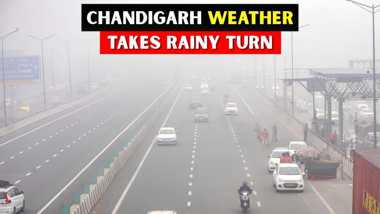
The skies over Chandigarh have dramatically shifted today, with thick clouds enveloping the city since early morning and dramatically raising the chances of rainfall. This isn’t just a passing drizzle – the latest Chandigarh weather updates indicate that residents should brace for moderate to heavy downpours that could significantly impact daily life and travel across the Tricity region.
Current Chandigarh Weather Conditions: A Morning of Change
From the very first light of day, the atmosphere in Chandigarh has been charged with moisture and anticipation. Several neighborhoods have already experienced light showers during the morning hours, a precursor to the more intense weather activity expected throughout the day. The Indian Meteorological Department (IMD) has been closely monitoring these developing conditions, and their forecasts paint a clear picture of what’s to come.
If you’re planning to step out, the advice is simple but crucial: do not forget to carry an umbrella. The intermittent nature of these showers means you could find yourself caught in a sudden downpour without warning. Commuters, in particular, should build extra time into their travel schedules as waterlogging on key arterial roads could cause significant delays.
IMD Issues Orange Alert for Punjab, Haryana, and Chandigarh
In a significant escalation of the weather warning system, the IMD has officially issued an Orange Alert for Punjab, Haryana, and Chandigarh. This alert level indicates that residents should be prepared for severely adverse weather conditions that could disrupt normal routines.
According to the latest Chandigarh weather forecast, heavy rainfall is expected to commence from Tuesday onward, with the intensity peaking over the next 24 to 48 hours. Here’s the detailed breakdown of what meteorological experts are predicting:
– May 6: Rain alerts are active for both Punjab and Chandigarh, with expectations of moderate to heavy precipitation
– May 7-8: The core of the weather system moves through the region, bringing the heaviest rainfall and potential thunderstorms
– May 9 onward: A relative dry spell is expected as the weather system weakens and moves away from the region
The Chandigarh weather center has also issued a Yellow Alert as a secondary precautionary measure. This lower-level alert serves as an early warning system, allowing residents and authorities to prepare for the more severe conditions that will follow. Interestingly, long-range forecasts suggest that this pattern of rainfall may continue into the coming weeks, with indications of sustained monsoon activity affecting the region.
Municipal Corporation Advisory: Essential Safety Measures
The Chandigarh Municipal Corporation (MC) has moved quickly to issue a comprehensive advisory for public safety, recognizing the serious nature of the approaching weather system. City officials are urging all residents to take the following precautions seriously:
– Avoid standing under trees: With heavy rains come increased lightning risks and the danger of falling branches, especially in areas with older, less stable trees
– Maintain distance from electrical poles and wires: Water conducts electricity, and during heavy rains, the risk of electrocution from damaged infrastructure increases substantially
– Steer clear of flooded areas: Even seemingly shallow floodwater can hide dangerous obstacles, open manholes, or electrical hazards
– Secure loose objects: Balconies and windowsills should be cleared of items that could become projectiles in high winds
– Check drainage around your property: Clear any blockages that could cause water to back up into your home or business
The MC has also mobilized its emergency response teams to handle potential waterlogging, fallen trees, and other weather-related emergencies as they arise.
Regional Weather Impact: Cyclonic Circulation and Monsoon Activity
Beyond the immediate forecast for Chandigarh, meteorologists are tracking a broader weather phenomenon that promises to keep the region wet for an extended period. A cyclonic circulation currently positioned over Haryana, combined with active monsoon dynamics, is expected to generate widespread rainfall across the northern region through at least August 6th.
This extended wet spell has significant implications for the area. For residents of Chandigarh, the primary benefit is the moderation of temperatures. Instead of the scorching heat typically associated with this time of year, the sustained cloud cover and rainfall will keep average maximum temperatures hovering around a comfortable 35 degrees Celsius. This is considerably cooler than the seasonal norms and provides a welcome respite from the intense summer heat.
Impact on Cricket Fans: IND vs AFG Test Match Concerns
Sports enthusiasts have a particular reason to keep a close eye on the Chandigarh weather as meteorological experts have flagged potential disruptions to the upcoming India vs Afghanistan Test match. The timing of this match coincides perfectly with the peak of the predicted rainfall, raising concerns about extended interruptions or even the possibility of shortened play.
Cricket fans planning to attend the match should prepare accordingly, arriving early to secure covered seating where possible and bringing appropriate rain gear. Those watching from home should adjust their expectations, as overs are likely to be lost to weather delays throughout the match.
Practical Guidance for Travelers and Farmers
The dual impact of these weather conditions affects two key groups particularly hard: travelers and farmers.
For travelers, the unpredictable nature of the rainfall means flexibility is essential. Flight schedules could face delays due to poor visibility, and road travel, especially on the highways connecting Chandigarh to nearby cities, may become hazardous during peak rainfall hours. If your journey is not essential, consider postponing it until the weather system has passed. If you must travel, ensure your vehicle is in good condition, your tires have adequate tread for wet roads, and you have emergency supplies on hand.
For farmers in the surrounding agricultural regions, these rains are a double-edged sword. On one hand, they provide essential moisture for standing crops, potentially reducing irrigation needs significantly. On the other hand, excessive rainfall can lead to waterlogging, crop damage, and the spread of fungal diseases. Agricultural experts recommend ensuring proper field drainage and delaying any pesticide or fertilizer applications until the rain has passed.
Looking Ahead: The Week’s Weather Outlook
Summing up the overall forecast, this week promises cooler-than-average conditions for Chandigarh with scattered to widespread rainfall likely across most days. The combination of the Orange and Yellow Alerts, the cyclonic circulation, and monsoon influences all point toward one conclusion: this is not a weather event to take lightly.
The Chandigarh weather situation remains fluid, and residents are advised to stay informed through official IMD channels for the most current updates. Local news outlets and the Municipal Corporation’s communication platforms will also provide timely information about any changes to the forecast or emerging emergency situations.
The key message from all authorities is consistent: stay indoors when possible, avoid unnecessary travel during peak rainfall hours, and follow all safety advisories. By taking these simple precautions, residents can safely weather this period of intense rainfall and emerge on the other side with minimal disruption to their lives and property.
Remember, when the sky darkens and the clouds gather over the City Beautiful, being prepared is your best defense. Keep your umbrella within reach, your phone charged for emergency alerts, and your plans flexible. The weather may be unpredictable, but your response to it doesn’t have to be.